About FlyWise - Aviation Navigation
Navigate wisely. FlyWise is a complete navigation system dedicated to the pilots, which helps you in every aspect of your navigation. A system designed to quickly respond to your questions in the air, even before you ask....
Navigate wisely.
FlyWise is a complete navigation system dedicated to the pilots, which helps you in every aspect of your navigation. A system designed to quickly respond to your questions in the air, even before you ask.
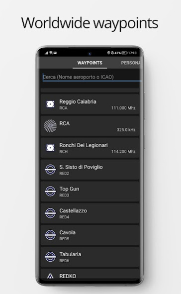
FlyWise is build on top of the Android standard guidelines and contains the most comprehensive database of airports, airfields, reporting points, radio facilities and airspaces.
Scheduling a flight with FlyWise is simple. It's enough to search by
ICAO ID or by the name of the airport / reporting point / radio aids or by coordinates.
Also you can view all the information of the airport of destination including weather situation updated in real time.
Connected to a bluetooth or wifi mini-AHRS device, FlyWise becomes a powerful
PFD showing speed, altitude, vertical speed, g-force, artificial horizon, compass.
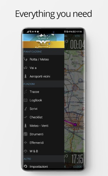
Main features:
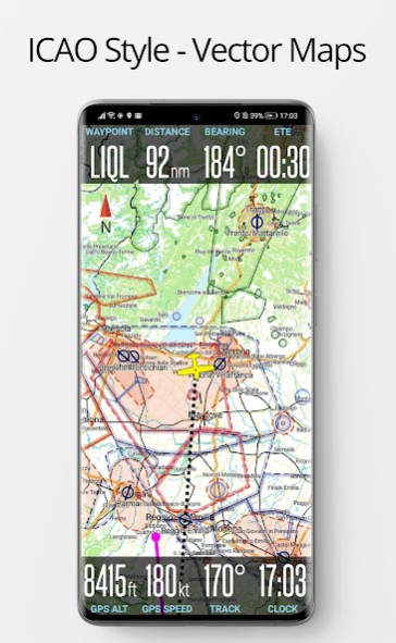
- Vector European
ICAO maps offline (you can use them in flight - no connection needed)
- Airspaces
- Altimetric profile
- Database of all waypoints: Airports, airfields, reporting points, radio facilities
- Automatic logbook: saves your takeoff time / landing and touch and go!
- With an
external AHRS module (sold separately) it becomes a powerful PFD: Artificial horizon and actual flight information, such as IAS, Pressure Altitude, G Force, VSI, ...
- Automatically track the distance and allows export to Google Earth or by e-mail
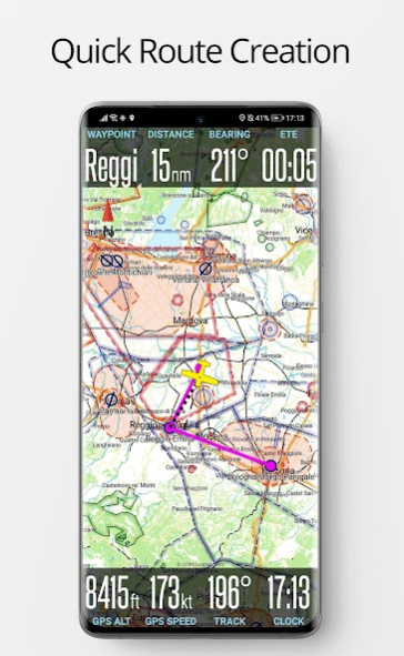
- Show routes, displays airspace
- Create, edit, import, share, export routes (GPX or Google Earth). Creating routes is simple, using the points directly on the map or using the database
- Create personal waypoints
- Flight planning: You can enter consumption values of your airplane and calculates consumption and distances on routes
- Calculates current ephemeris
- Get weather information along the way
- You can add your own maps or approach maps, so that they are overlayed on maps
The data on the waypoints are updated each
AIRAC cycle.
FlyWise supports the following ADS-B / AHRS:
- iLevil
- Stratux
You can download the
user manual from here: http://www.voodoo-dev.com/fw-manual-en.pdf
WARNING: USE THIS APPLICATION ONLY AS AID FOR VISUAL FLIGHTS !!! WE ARE NOT RESPONSIBLE FOR ANY OTHER USE.
If you have suggestions, write us, we will be happy to answer them.
Previous Versions
Here you can find the changelog of FlyWise - Aviation Navigation since it was posted on our website on 2017-01-19 04:29:43.
The latest version is 2.5.0 and it was updated on 2024-04-22 22:15:40. See below the changes in each version.
FlyWise - Aviation Navigation version 2.5.0-beta7
Updated At: 2023-02-15
FlyWise - Aviation Navigation version 2.3.22
Updated At: 2021-04-08
Changes: Small bugfixes on Metar
FlyWise - Aviation Navigation version 2.3.19
Updated At: 2020-12-11
Changes: Small bugfixes
FlyWise - Aviation Navigation version 2.3.15
Updated At: 2020-08-11
Changes: Meteo / Notams Fixes
Export Google KML Fix
Tracking service Bugfix
Added TMAs
FlyWise - Aviation Navigation version 2.3.11
Updated At: 2020-02-23
Changes: Export Google KML Fix
Tracking service Bugfix
Added TMAs
FlyWise - Aviation Navigation version 2.3.10
Updated At: 2019-12-09
Changes: Tracking service Bugfix
Added TMAs
FlyWise - Aviation Navigation version 2.3.9
Updated At: 2019-11-20
Changes: Bugfix
FlyWise - Aviation Navigation version 2.3.6
Updated At: 2019-08-01
Changes: Increased license timeout
Enhancement: New database structure, increased map scrolling speed: PLEASE UPDATE YOUR COUNTRY DATA FROM THE SETTINGS -> MANAGE DATA
Enhancement: Better profile sizing for Altimetric Profile - increased to 6nm
New feature: You can now put in the folder FlyWise/tc your geo-referenced terminal charts, they will be shown when the speed is under 30 knots.
Bugfix: Send tracks via e-mail
FlyWise - Aviation Navigation version 1.7.6
Updated At: 2016-12-24
Changes: PRO version - updates:,- New Map Engine - faster,- Rate of Descent Calculator,- Maximum Elevation Calculator,- Android Nougat 7.1 support,- New, more detailed maps: powerlines, airports (runway, taxiway, hangar), wind turbines,- Bugfix,- Database updates now managed internally,- Meteo / Taf section updates,As always we are more than glad to answer any question
Disclaimer
Official Google Play Link
We do not host FlyWise - Aviation Navigation on our servers. We did not scan it for viruses, adware, spyware or other type of malware. This app is hosted by Google and passed their terms and conditions to be listed there. We recommend caution when installing it.
The Google Play link for FlyWise - Aviation Navigation is provided to you by apps112.com without any warranties, representations or guarantees of any kind, so access it at your own risk.
If you have questions regarding this particular app contact the publisher directly. For questions about the functionalities of apps112.com contact us.